9 Comments
동쪽마녀
2014.08.18 02:03
어!
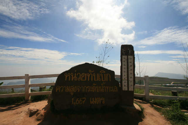
1,667이면 고지대인데.
이싼은 평야지대만 있는 게 아니었구먼요!!
1,667이면 고지대인데.
이싼은 평야지대만 있는 게 아니었구먼요!!
펀낙뺀바우
2014.08.18 20:15
대부분 평야가 많습니다만 이싼 초입인 코랏(카오야이)과 러이 등은 굉장한 산악지대입니다.
울산울주
2014.08.18 06:54
펫차분은 이싼 아닌데여.. 차야품부터 이싼이고
펀낙뺀바우
2014.08.18 20:18
아하! 그렇군요.
후아힌이 중부라고 하는 것과 비슷한 이야기네요.
이곳은 펫차분과 러이의 두 주에 걸쳐있으니 이싼도 맞을 듯합니다.
덕분에 배우고 갑니다.^^*
후아힌이 중부라고 하는 것과 비슷한 이야기네요.
이곳은 펫차분과 러이의 두 주에 걸쳐있으니 이싼도 맞을 듯합니다.
덕분에 배우고 갑니다.^^*
이싸라
2014.08.18 21:26
http://www.youtube.com/watch?v=C9Takd67uoY
Ban Thap Boek
Attraction Details :
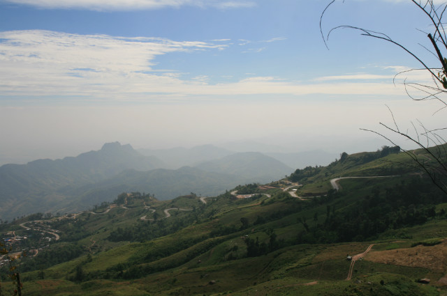
This Tambon is home to a Hmong hill tribe village called Ban Thap Boek. The area lies 1,768 meters above sea level and is often referred to as the highest point in Phetchabun province. Mountainous terrain and high altitudes guarantee year-round cool weather for visitors. The area is also culturally significant: it served a catchment area for rainwater used in a sacred ceremony during His Majesty the King’s auspicious 72nd birthday anniversary.
From December to January, during the cool season, the hills are covered in cherry blossoms, making it the perfect time to visit. During the rainy season, mists engulf the hills both day and night, earning it the moniker of “the Misty Town”. A hiking event (“Climb up to Thap Boek, Experience the Coolness and Watch the Stars on the Ground”) is held to take advantage of the beautiful nighttime scenery, where at the end of the hike, participants can admire Lomsak and Lomkao towns’ twinkling lights below. The Phetchabun Tourism Association provides bungalows and tents for rent, and a campsite (with an admission fee) is also available for those who bring their own tents.
Thap Boek is located at Mu 14 in Tambon Wang Ban, Amphoe Lom Kao, Phetchabun. To get there From Phetchabun, take Highway No. 21 to Amphoe Lom Sak for 40 kilometers. At Amphoe Lom Sak, take Highway No. 203 for 13 kilometers and turn left into Amphoe Lom Kao. Proceed further for 5 kilometers, passing Ban Wang Ban. Go straight on until the end of the road, then turn left into Highway 1143 for 1 kilometer, and turn right into Highway 2331, passing Huai Nam Rin Village until Km. 18-19, prior to the checkpoint to the park. There will be a direction sign into Thap Boek Village. Turn right and drive for another 4 kilometers. (Note: The route is very steep and winding. Visitors should drive a high-power vehicle and take special precautions.)
Operating hours are 6.00 am-6.00 pm. For additional information, contact the Phetchabun Tourism Association at 0 5670 9026 or 08 1680 0223.
http://www.tourismthailand.org/See-and-Do/Sights-and-Attractions-Detail/Ban-Thap-Boek--4879
백발아재
2014.08.22 23:33
롬싹지역에 있는 캠핑장으로 사람들이 많이 찾는곳이지요.
공심채
2014.08.24 21:42
워우.. 저 꼬불꼬불한 길이라니.. 오토바이 타고 달리면.. 연중 시원한 날씨에 건기에는 cherry blossom이라니.. 콘깬을 거점으로 차이야품 지역을 돌아보고 오는 루트를 그려볼까하던 중인데 좀 무리가 있더라도 여기까지 넣어서 원형 루트를 그려보는 것도 괜찮을 것 같다는 생각이 드네요.. 감사합니다.
펀낙뺀바우
2014.08.28 15:43
차로 올라가도 멋진 곳인데 공심채님처럼 바이크로 라이딩하시면 감흥이 더 새롭겠네요^^
만약에 여기를 가신다면 푸힌롱끄라 국립공원도 넣으시면 어떨까합니다...사진의 푯말에서 약간 올라가면 좌회전은 푸힌롱끄라...우회전은 푸탑벅입니다.
만약에 여기를 가신다면 푸힌롱끄라 국립공원도 넣으시면 어떨까합니다...사진의 푯말에서 약간 올라가면 좌회전은 푸힌롱끄라...우회전은 푸탑벅입니다.
공심채
2014.08.28 23:09
좋은 정보 감사합니다~


